


Öveket becsatolni!
Kedves Látogatóink!
Az országos harmadfokú hőségriadóra tekintettel
Öveket becsatolni! c. kiállításunk 2026. 06. 27-én és 2026. 06. 28-án zárva tart.
Ezúton is köszönjük szíves megértésüket!
Az Öveket becsatolni! című időszaki kiállítás az Északi Járműjavítóban szerdától vasárnapig 10 és 17 óra között látogatható.
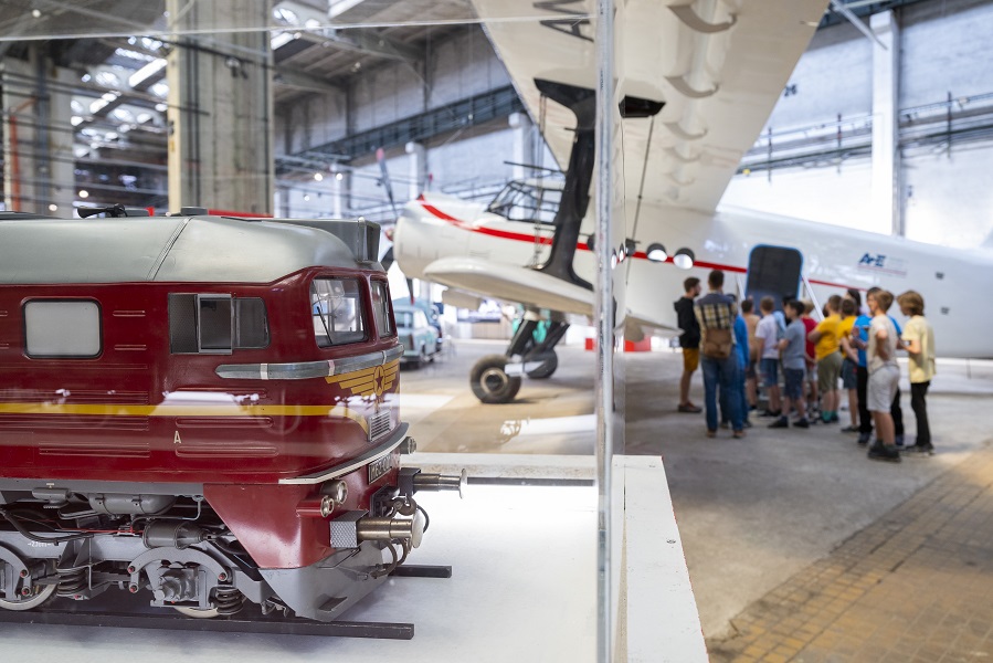
Az új tárlaton – fogatolt, hajózási, közúti, légi, vasúti és városi gyűjteményünk műtárgyainak segítségével – végigkövethetik a közlekedésbiztonság történetét, Törley József esetétől a Magyar Királyi Posta autósiskoláin át, a nagyhatalmi vezetők privát járműveiig. Bemutatjuk a mai radarokat, kamerákat, és szót ejtünk a mesterséges intelligenciával működő innovációk világáról, sőt a KRESZ jövőjéről is.
A 2026. június 20-tól látogatható kiállítás mellett számos izgalmas kísérőprogramon vehetnek részt. A korábbi években népszerűnek bizonyult tematikus rendezvényeken túl idén közlekedésbiztonságunk témakörét vizsgáljuk meg különböző megközelítések mentén, előadások, múzeumpedagógiai foglalkozások, szimulátorok segítségével és külsős vendégek bevonásával. Fény derül arra, mikor vezették be a légzsák használatát, mikor biztonságos a közlekedés egy elektromos rollerrel, és hogyan reagáljunk, ha balesetet látunk, vagy milyen változásokat hozhat az új KRESZ, illetve hogyan épül fel egy ideális város.
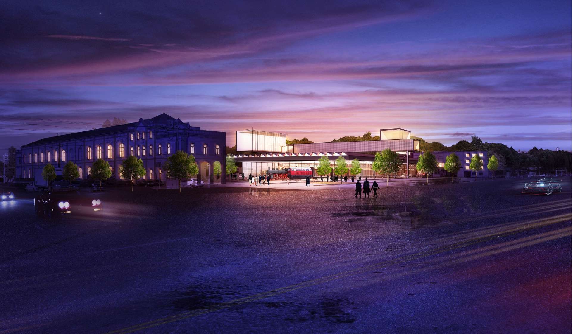
Fedezze fel a közlekedésbiztonság múltját, jelenét és jövőjét 2026. október 31-ig a megújulás előtt álló Északi Járműjavító tereiben, a Közlekedési Múzeum leendő új otthonában!
Szörényi Szabolcs vasúti terepasztala tárlatvezetés keretében tekinthető meg, amelyen előzetes regisztrációval lehet részt venni. Regisztrálni az Opera Eiffel Műhelyház honlapján lehet. Amennyiben nem talál szabad időpontot, kérjük szíves türelmét. Az új időpontok megnyitása folyamatosan történik.


Nyitvatartás
Szerda-vasárnap | 10:00–17:00
Jegyinfó
Kiállításunkon a helyszínen készpénzzel és bankkártyával is tud fizetni, valamint online is megvásárolhatja a jegyét az alábbi linkre kattintva:
Jegyárak:
Felnőtt belépőjegy: 3500 Ft/fő
Kedvezményes (50%) belépőjegy: 1750 Ft/fő
Kedvezményes belépésre (50%) jogosultak köre:
- 6 és 26 év közötti látogató, kedvezményre jogosító igazolvány felmutatásával
- 62 év felettiek
- legalább két, 18 év alatti személyt kísérő, a Polgári Törvénykönv szerinti közeli hozzátartozó (legfeljebb 2 fő)
- "Szakmai beszélgetés kupon" felmutatásával a szakmai beszélgetések látogatása
- egyedi alkalomra meghirdetett esetben, a meghatározott feltétel fennálása esetén
- aki a társadalombiztosítási nyugellátásról szóló 1997 évi LXXXI. 18. § (2a) bekezdése szerint öregségi teljes nyugellátásban részesül
- érvényes újságírói igazolvánnyal rendelkezők
Díjtalan belépésre jogosultak köre:
- 6. életévüket be nem töltött kiskorúak, valamint a 70. életévüket betöltött személyek,
- a fogyatékos személyek jogairól és esélyegyenlőségük biztosításáról szóló 1998. évi XXVI. törvény 4. § a) pontja szerinti fogyatékos személyek,
- a fogyatékos személyt kísérő legfeljebb 1 fő,
- a miniszter által kiadott szakmai belépővel rendelkezők,
- a legalább 400 fős taglétszámmal rendelkező, országos hatáskörű közgyűjteményi szakmai szervezet tagjai (Pulszky Társaság – Magyar Múzeumi Egyesület, Magyar Könyvtárosok Egyesülete, Magyar Levéltárosok Egyesülete),
- Magyar Vidéki Múzeumok Szövetségének Tanintézményeinek dolgozói
- a köznevelésben dolgozó pedagógusok, szakképzésben
Családi jegy (két felnőtt és két 18 év alatt gyermek számára): 6000 Ft/db
Családi kiegészítő jegy (családi jegy kíséretében): 600 Ft/gyermek
Csoportos felnőtt belépőjegy (10 főtől): 2500 Ft/db
Csoportos kedvezményes belépőjegy (10 főtől, 26 év alattiak, közoktatásban résztvevők): 1250 Ft/db
Iskolás csoport (60 főtől, előzetes bejelentkezést követően: frontline@kozlekedesimuzeum.hu): 500 Ft/fő
Múzeumpedagógiai szolgáltatás (előzetes bejelentkezést követően: frontline@kozlekedesimuzeum.hu, nem tartalmazza a belépőjegyet): 500 Ft/fő
Tárlatvezetések (előzetesen meghirdetett időpontokban, nem tartalmazza a belépődíjat): 1000 Ft/fő
Tárlatvezetés családi jegy kíséretében (előzetes bejelentkezést követően: frontline@kozlekedesimuzeum.hu): 2000 Ft/család
Tárlatvezetés csoportoknak (20 főtől, előzetesen meghirdetett időpontokban, nem tartalmazza a belépődíjat): 5000 Ft/csoport
Megközelítés
Az Északi Járműjavító területén nincs parkolási lehetőség. A kiállítás helyszíne azonban közösségi közlekedéssel kiválóan megközelíthető, ezért javasoljuk, hogy ezt a fenntarthatóbb utazási módot válassza.
Parkolóhelyet kizárólag mozgáskorlátozott látogatóink számára tudunk biztosítani, előzetes igényjelzés alapján az info@kozlekedesimuzeum.hu e-mail-címen.


A kiállítás tömegközlekedéssel az alábbi módokon közelíthető meg:
-
a Blaha Lujza tértől a 28-as, 28A vagy 62-es villamossal 8 megálló, 13 perc, az Eiffel Műhelyházig utazva.
-
A belvárostól, pl. a Deák Ferenc tértől 9-es busszal 11 megálló, 20 perc, az Eiffel Műhelyházig utazva.
-
A kiállítás az 1-es villamossal is megközelíthető, így a Kőbányai út / Könyves Kálmán körút megállónál kell leszállni, ahonnan mintegy 5-7 perc séta vagy egy megálló a 28, 28A vagy 62-es villamossal a kiállítás bejárata.
Autóval érkező látogatóinknak az Opera Eiffel Műhelyházát érdemes beírni a GPS-be. Kérjük, vegyék figyelembe, hogy a helyszínen sajnos helyhiány miatt parkolási lehetőséget nem tudunk biztosítani, ezért a tömegközlekedés használatát ajánljuk!
A kiállítás helyszínén 3 db akadálymentes parkolóhelyet biztosítunk az arra rászorulók számára. Kérjük, amennyiben ezen parkolóhelyeket igénybe venné, az info@kozlekedesimuzeum.hu email címen jelezze!
A kiállítás kerékpárral gyorsan és könnyen elérhető, mind a Könyves Kálmán körúton, mind a Kőbányai úton végig kerékpárút halad. A bejáratnál 20 darab kerékpártároló áll rendelkezésre.
Kiállításunk az összes fővárosi autóbusz- és vasúti pályaudvarról kitűnően megközelíthető, az alábbiak szerint:
- A Keleti pályaudvartól a 2M-es, vagy a 24-es villamosra felszállva az Orczy térig, majd onnan a 28-as, 28A vagy a 62-es villamosra átszállva további 4 megállót kell utazni az Eiffel Műhelyházig.
- A Déli pályaudvartól a 2-es metróval a Puskás Ferenc Stadion állomásig, majd az 1-es villamossal a Kőbányai út / Könyves Kálmán körút megállóig utazva, onnan pedig 4-5 perc sétával lehet megközelíteni az épületet.
- A Nyugati pályaudvartól a 9-es autóbusszal 15 megállót követően az Eiffel Műhelyháznál leszállva lehet elérni az Északi Járműjavítót.
- Kelenföld vasútállomástól, a Puskás Ferenc Stadiontól és a Népligettől egyaránt az 1-es villamossal lehet elérni az Északi Járműjavítót, a Kőbányai út / Könyves Kálmán körút megállónál kell leszállni, onnan pedig 5-7 perc sétával közelíthető meg, vagy egy megállót megtéve a 28-as, 28A vagy a 62-es villamossal.
A kiállítás helyszínén két darab buszparkolót biztosítunk a csoporttal érkezőknek. Kérjük, amennyiben ezen parkolóhelyeket igénybe venné, jelezze az info@kozlekedesimuzeum.hu email címen!
Múzeumpedagógia
A Magyar Műszaki és Közlekedési Múzeum fővárosi tagintézményeiben idén is szeretettel várunk minden érdeklődő iskolás csoportot egyedi élményt nyújtó múzeumpedagógiai foglalkozásainkra. A technika- és közlekedéstörténeti ismeretek bővítése mellett teret biztosítunk a kreativitásnak és a korszerű ismeretátadásnak. Gazdag és sokszínű múzeumi gyűjteményünk lehetővé teszi a kevésbé műszaki érdeklődésű tanulóknak is, hogy megtalálják a számukra izgalmas és inspiráló elemeket a múzeumlátogatásuk során.
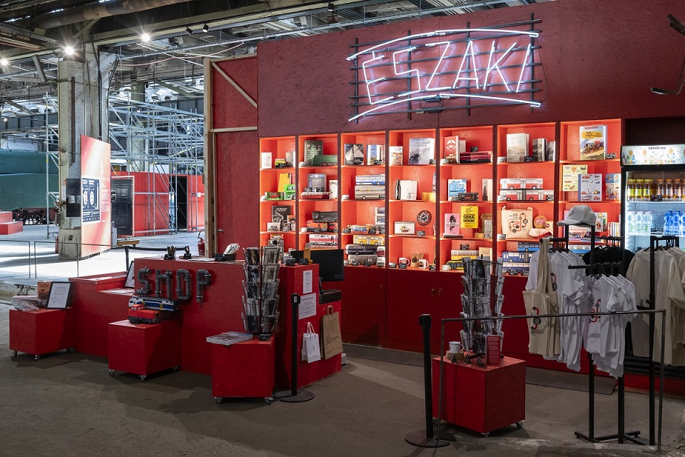
Múzeum Shop
Vigyen haza egy emléket a kiállításról! Múzeum Shopunkban a kerékpár történetét bemutató könyvek, játékok, kiegészítők egyaránt megtalálhatóak.
Webshopunk kínálatát is figyelmükbe ajánljuk
Támogatóink:


Lábléc
Kapcsolat
Cím: 1101 Budapest, Kőbányai út 24-28.
Telefonszám (szerdától vasárnapig, 10 és 17 óra között hívható): +36 70 702 4024
E-mail: info@kozlekedesimuzeum.hu
Adatkezelés
© 2026 Magyar Műszaki és Közlekedési Múzeum